
Visiting Arlington County and Washington, DC means leaving the car behind, and exploring the area as the locals do—biking, walking, and public transit. This is especially important during peak visitor seasons and special events. This Washington, DC and Arlington visitors guide aims to help you navigate to top tourist destinations without a car.
Armed with some initial tips and strategies, here are more details about accessing key attractions in both Arlington and Washington, DC.
Go to:
| 1. Traveling Around Arlington | 2. Arlington Memorials and Attractions
| 3. Traveling Around Washington, DC | 4. Washington, DC Memorials and Attractions
1. TRAVELING AROUND ARLINGTON
Riding Metrorail
Arlington County has 11 Metrorail Stations and connects to a larger system that allows visitors to access Washington, DC; Maryland; and other parts of Northern Virginia. Fares are based on distance traveled and visitors can access the system with a SmarTrip card. Download our top commute/travel apps to be prepared for your journey.
Biking
Arlington is a Silver Level Bicycle Friendly Community, and a Bicycle Comfort Map will show you the most comfortable way to get around the County.
- Capital Bikeshare is an easy way to cruise around Arlington and the city. The popular big red bikes can be found all over the area and you only need to use the Capital Bikeshare app to help you find available bikes and empty docks. Just remember, the first 30 minutes are always free, but any time after that results in a fee.
Riding the Bus
For $2.00 per trip, Arlington’s ART bus and Metrobus are an easy way to travel across the County.
- Use cash or get a SmarTrip card to ride the bus. Purchasing a card means not having to worry about exact change for every trip; plus, it gives you free or discounted transfers to other buses or Metrorail.
- Buy the cards at many hotels, Metro Stations, select CVS and Giant stores, or one of four Commuter Stores in Arlington; $10 will get you the $2 card and $8 fare. You can add additional fare at any SmarTrip kiosk, bus, or online.
- Look for bus stops on this interactive map and read about more Rider Tools on the ART website.
- When you board the bus, tap the card on the identical image on the bus farebox. The readout will tell you if it worked and how much money is left on the card. The driver can also help you add fare and answer questions about routes.
- Review public transportation etiquette, to make sure you don’t make a tourist faux pas. Being polite is an important part, but so is not eating and drinking while on the bus or Metrorail.
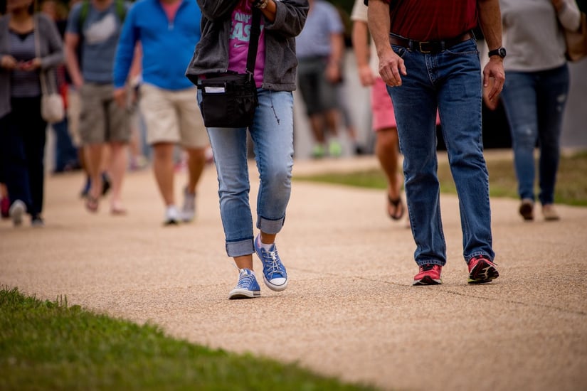
Walking
Arlington has been designated a Gold Level Walk Friendly Community.
- You can walk to a destination or enjoy the self-guided Walkabouts from WalkArlington. Visit parks, discover restaurants, find unique shops, and see the sites.
2. ARLINGTON MEMORIALS AND ATTRACTIONS
Pentagon Memorial
The Pentagon Memorial is one of the newer memorials in Arlington County. It was dedicated on September 11, 2008 and was built to remember and honor those who died because of the events of September 11, 2001 at the Pentagon. Each memorial unit is also positioned to distinguish victims who were in the Pentagon and those who were on board the American Airlines flight.
The Pentagon Memorial is open 24 hours a day, 7 days a week; however, you should take note of your timing as some services may not run or may not be as frequent.
Pentagon Memorial by Metrorail
The Pentagon Memorial is at the Pentagon. Visitors can reach the Pentagon via Metrorail as there is a metro stop with direct access. Exit the station and follow the walking directions below.
Pentagon Memorial by Bicycle
If you wish to use Capital Bikeshare to get to the Pentagon Memorial, the closest Bikeshare stations are near the Pentagon City Metro station: 12th and S Hayes Street, and S Joyce and Army Navy Drive. Once you dock your bike, follow the walking directions below. There are also bike racks at the Pentagon Memorial, if you wish to ride a regular bike and lock up there.
Pentagon Memorial by Bus and Walking
Visitors can also reach the Pentagon Metro Station by a few different buses.
- ART 42 (runs from Ballston to the Pentagon Metro Station)
- ART 87 (Shirlington to Pentagon Metro Station)—on weekends, the route goes to the Pentagon City Metro instead of the Pentagon Metro, making it easy to visit the shops, restaurants and businesses in Pentagon City.
Once you’ve arrived at the Pentagon Metro Station, exit the station, turn right and walk .5 miles (about 9 minutes), following signs to the memorial.
Read the full blog about this memorial and mode options.
Air Force Memorial
The US Air Force Memorial was first dedicated in 2006, and honors the service of the men and women in the United States Air Force. If you’re visiting the Pentagon Memorial, you’ll be able to see the Air Force Memorial too without much additional travel effort/time.
Air Force Memorial by Metrorail
You can't reach the Air Force Memorial only by Metrorail. After arriving at Pentagon or Pentagon City Metro Station, you can either walk or take the bus. See below for directions by either mode.
Air Force Memorial by Bicycle
The Air Force Memorial is located at the top of the hill on Columbia Pike. The closest Capital Bikeshare station is at Columbia Pike and S Orme Street, next to the Sheraton Pentagon City.
Air Force Memorial by Bus
To get to the Air Force Memorial by bus, stand near the Pentagon City Metro Station at S Hayes St and 12th St; facing The Fashion Centre at Pentagon City.
To get to the memorial from Pentagon City, catch any Metrobus 16 that runs from this bus stop. That means 16A, 16Y, 16D—any of them! Just let the driver know that you’d like to get off at the Navy Annex stop. You’ll actually pass the Memorial on your right; just cross the street at the light and it’s a quick walk back down the hill to the Memorial entrance. You can walk back down the hill to Pentagon/Pentagon City or just hop on any returning Metrobus 16 at the same stop.
Air Force Memorial by Walking
Walking is definitely our recommended mode of transportation. From Pentagon City Metro Station, the Air Force Memorial is 1.1 miles away (22-minute walk). You should be able to see the spires as soon as you cross under the bridge on S Joyce Street, if not before. You can also walk from the Pentagon Metro Station as well.
Read the full blog about this memorial and mode options.
Marine Corps War Memorial (Iwo Jima)
The Marine Corps War Memorial, commonly referred to as Iwo Jima, is located in the urban village of Rosslyn. When you visit Iwo Jima, you’ll also get a great view of DC across the river and a bonus memorial sighting with the Netherlands Carillon right next door.

Iwo Jima by Metrorail
To visit Iwo Jima, travel to Rosslyn Metro Station on the Orange, Blue, or Silver Lines. After you exit the station, following the walking directions below.
Iwo Jima by Bicycle
After you’ve arrived in Rosslyn by bus or metro, check out a bike from the nearest Capital Bikeshare station, located at the corner of N Fort Meyer Drive and Wilson Boulevard. Take a short ride down N Fort Myer Drive, onto N Meade Street and you’ll find a Capital Bikeshare station at the top of the memorial. You may ride your bike around the memorial, but remember to be respectful and do not ride in pedestrian only areas.
Iwo Jima by Bus
To get to Iwo Jima by bus, you’ll need to take any bus into Rosslyn. Your options are listed below; click any route to view a full timetable and map:
- Metrobus 38B (runs from Ballston-MU Metro Station to Farragut West Metro Station and vice versa, with stops in Rosslyn)
- ART 43 (runs from Crystal City to Courthouse and vice versa, with stops in Rosslyn)—note that ART 43 only runs Monday-Friday, during rush hour
- ART 45 (runs from Columbia Pike to Rosslyn and vice versa, terminating at Rosslyn Metro Station)
From Rosslyn Metro Station, Iwo Jima is a 14-minute walk (.7 miles) south. You should be able to see the Memorial in front of you as you approach it.
Iwo Jima By Walking
Less than a mile to the memorial from the Rosslyn Metro Station, you can walk down N Meade Street or N Lynn Street.
Read the full blog about this memorial and mode options.
Arlington National Cemetery
Located across the Potomac River, at the end of the Memorial Bridge, Arlington National Cemetery is a humble experience for both visitors and residents. Whether you stop in to pay your respects, watch the changing of the guard at the Tomb of the Unknown Soldier, or visit JFK’s grave site, getting to Arlington National Cemetery doesn’t have to be a headache. In fact, it’s pretty easy when you use public transportation.
Arlington National Cemetery by Metrorail
You can visit Arlington National Cemetery by Metrorail. With a dedicated stop at the cemetery, visitors can travel on the Blue Line for easy access to the front of the cemetery and the visitor center.
Arlington National Cemetery by Bicycle
You can use your own bike or Capital Bikeshare to get near the Cemetery, and walk the rest of the way. The closest Bikeshare station to the north is near the Iwo Jima Memorial – dock your bike at N Meade and 14th Street N, then walk past Iwo Jima and Netherlands Carillion to get to the Cemetery. Either follow the multi-use trail or walk through the Cemetery itself.
If you choose to ride a regular bicycle, you can reach the Cemetery Welcome Center on the Mount Vernon Trail. Use the Custis Trail in north Arlington or the Four Mile Run Trail in mid-Arlington to connect to the Mount Vernon Trail, or study the Comfort Level Bike Map for lower traffic route options.
Arlington National Cemetery by Bus
You can use several buses to reach Rosslyn, then walk follow the same path as you would if you docked your Capital Bikeshare bike.
Your options are listed below; click any route to view a full timetable and map:
- Metrobus 38B (runs from Ballston-MU Metro Station to Farragut West Metro Station and vice versa, with stops in Rosslyn)
- ART 43 (runs from Crystal City to Courthouse and vice versa, with stops in Rosslyn)—note that ART 43 only runs Monday-Friday, during rush hour
- ART 45 (runs from Columbia Pike to Rosslyn and vice versa, terminating at Rosslyn Metro Station)
Arlington National Cemetery by Walking
If you’re planning to visit Arlington National Cemetery, there’s a pretty good chance you’re already out and about checking out other memorials in DC.
Let’s say you’re already up to the Lincoln Memorial and you see Arlington Cemetery just across the Memorial Bridge. Instead of trekking all the way back to Smithsonian Metro Station or L’Enfant Plaza Metro Station, which is a 1.2 mile hike, you can use that time to walk to Arlington National Cemetery. The walk from the Lincoln Memorial to the Cemetery Welcome Center is actually less than the walk back to the Metro Station and is exactly 1.1 miles. This 25-minute walk will give great views of DC and Arlington as you cross the Memorial Bridge.
Read the full blog about this memorial and mode options.
3. TRAVELING AROUND WASHINGTON, DC
Washington, DC, is a compact 61 square miles of land edging the Potomac River. This river separates the United States federal government, numerous monuments and museums, embassies, and some of the best restaurants from Arlington County. Routes across the Potomac are limited if not using Metrorail, but crossing the Key Bridge into Georgetown is the best way into the district.
Regardless of which mode of transportation you pick, you will cross one of four bridges that connect Arlington and Washington, DC:
- Francis Scott Key Bridge (commonly known as the Key Bridge)
- Theodore Roosevelt Bridge
- Arlington Memorial Bridge
- 14th Street Bridge
From Rosslyn, the Key Bridge is the main crossing, with a wide range of transportation options. From Crystal City and southern Arlington locations, the 14th Street Bridge is closest. You can walk and bike across all four bridges, taking you to different locations within DC, but buses do not cross all of them. More details below.

Into Washington, DC by Metrorail
From Arlington, there are four Metrorail lines that can help you access Washington, DC. The Yellow Lines from Pentagon City will place you closer to the National Mall and Smithsonian museums. The Blue, Orange, and Silver Lines will take you downtown DC and more towards the local part of town. The National Mall and Smithsonians are still accessible from these lines.
Into Washington, DC by Bicycle
Biking into Washington, DC by bike is one of the easiest, most reliable ways to get across the water.
- Rosslyn to Georgetown via Key Bridge: Capital Bikeshare from Lynn and 19th Street N dock, north on N Lynn Street towards the Key Bridge into Georgetown. Be extra alert as you cross the divided lanes of Lee Highway. Once you cross the bridge, you will be on M Street, which has no bike lane. Keep your eyes on traffic while you head to the closest Capital Bikeshare dock; the one on Wisconsin sets you in the heart of Georgetown’s best shopping and dining. You can pick up another bike at the eastern edge of Georgetown, at M Street and Pennsylvania Avenue NW.
- Rosslyn into DC via Roosevelt Bridge: To access the Roosevelt Bridge, you’ll need to bike to the Mount Vernon Trail (MVT) from the Custis Trail in Rosslyn. Follow the MVT to cross the bridge into DC. Once you cross the Roosevelt Bridge, you will find yourself next to the John F. Kennedy Center for the Performing Arts. Find a Capital Bikeshare dock on F Street NW to dock your bike and walk into Georgetown or towards Foggy Bottom, or keep the bike and keep going.
- Rosslyn into DC via Arlington Memorial Bridge: Crossing on the Memorial Bridge will put you right next to the Lincoln Memorial, and from there you can either access the rest of the National Mall with your Bikeshare bike (get a new one after 30 minutes to avoid overage fees) or on foot.
- Crystal City into DC via 14th Street Bridge: Also connecting to the MVT, this bridge will guide you directly to the Thomas Jefferson Memorial and a Capital Bikeshare station. From there you can leisurely stroll around the Tidal Basin, which is lovely with and without cherry blossoms. Before you head across the bridge, consider stopping just south of the bridge at Gravelly Point to watch airplanes take off and land from Reagan National Airport.
Into Washington, DC by Bus
These bus routes going into DC all end in Farragut Square, which is perfect for checking out the sights. The White House, the Renwick Gallery, the National Geographic Museum, and the National Mall are all walking distance from Farragut Square. Just make sure you are familiar with the route days and hours.
- Metrobus 3Y (Lee Highway to Farragut Square) Note: only Monday-Friday, into DC in the AM and out of DC in the PM. No Saturday or Sunday service, or on Columbus Day, Veteran’s Day, Martin Luther King Jr Day, and Presidents’ Day.
- Metrobus 16Y (Columbia Pike to Farragut Square) Note: only Monday-Friday, into DC in the AM and out of DC in the PM. No Saturday or Sunday service, or on Columbus Day, Veteran’s Day, Martin Luther King Jr Day, and Presidents’ Day.
- Metrobus 38B (Ballston to Farragut Square) Note: Ride anytime.
The 38B is sometimes called “The Orange Line with a View” since it follows the Metrorail Orange Line, but instead of tunnels you get views of Georgetown Waterfront, Georgetown University, and the Kennedy Center as the bus crosses the bridge. This workhorse bus is our favorite for getting to/from anywhere along the Rosslyn-Ballston Corridor into Washington, DC at just about any time of the day.
The Circulator is our other favorite way to get into DC from Rosslyn. Not familiar with DC Circulator? These luxurious red buses only cost $1.00 each trip (you can use your SmarTrip card), run every 10 minutes and in loops—or rather, they circulate. You can read more about how to ride the Circulator and study their interactive map, which will help you jump from one loop to the next to leapfrog into DC, as each loop connects with another. In fact, the Circulator goes through enough different neighborhoods, that for a few dollars, you can get a local’s view of DC as you check out each route.
Into Washington, DC by Foot
You can easily walk into Washington, DC across any of the four bridges, but some are easier to cross than others. For example, walking from the Crystal City Water Park to the Lincoln Memorial is almost a four mile walk along the Mount Vernon Trail, across the 14th Street Bridge and along the Potomac on Ohio Drive SW. On the other hand, walking from Rosslyn into Georgetown is a quick, less than a mile route.
Around DC by Bike
- Bikes are welcome on the National Mall, but be aware of others around you, and walk your bikes through ALL memorials. Bike riding in the memorials is not permitted. Read more on the National Mall and Memorial Parks Bicycling Information
- Use the Capital Bikeshare station map to find stations and bikes. Remember, the first 30 minutes are free and if you keep the bike longer than that, fees will accrue!
- The Washington DC Department of Transportation (DDOT) offers a pocket guide to bicycle rules in the District. Key points: follow traffic laws, don’t bike on the sidewalks within the Central Business District and a bicyclist must ride with traffic, not against it.
- DDOT also offers bicycle maps on their website, which are must-reads if you really want to cruise around the city by bicycle.
Around DC by Foot
- The DC Bicycle Maps are actually great maps for walking as well, so definitely check them out.
- Although there are many distinct neighborhoods in DC, the District is small enough that you can easily find yourself walking further than you expected! Luckily, there are plenty of excellent restaurants in which to rest your weary feet.
4. WASHINGTON, DC MEMORIALS AND ATTRACTIONS
Chinatown
Chinatown is full of hip and fun restaurants, and conveniently located just over a mile east of Farragut Square and about 1.5 miles north of the National Mall. Once you’ve reached Farragut Square by bus, it’s a short walk or bike ride to the center of Chinatown, where you can see the dramatic Friendship Archway (or commonly known as the Chinatown Gates). From the Washington Monument, walk through the National Mall or bike up the 15th Street NW protected bike lane the way the locals do.
Jefferson Memorial
Reach the Jefferson Memorial from Crystal City across the 14th Street Bridge. It might be more commonly known as the place with the cherry blossoms, but don’t neglect Tom. Read the quotes carved into the marble inside the Memorial before you move on. Across the Tidal Basin you can see the Martin Luther King Jr Memorial; a casual stroll around the water’s edge will get you there in no time.
The Mall—Capitol
The East end of The National Mall houses the US Capitol, the Library of Congress, the US Supreme Court, and many other important attractions. Conveniently, all are located within a few blocks of each other, so they are easy to reach by foot. You can ride Capital Bikeshare on streets within the Mall; check this simplified map to find nearby docks.
The Mall—Lincoln Memorial
Crossing the Memorial Bridge will put you right by the Lincoln Memorial at the far western end of the National Mall. Abraham Lincoln sits and watches over the entire stretch of the mall, including the Korean War Veterans Memorial, Vietnam Veterans Memorial, World War II Memorial, Washington Monument, Martin Luther King, Jr Monument, as well as the Reflecting Pool, Tidal Basin, and countless other worthy sites.
The Mall – Smithsonian Museums
In between the Lincoln Memorial and the US Capitol are a slew of Smithsonian Museums with several other museums and galleries mixed in. Top museums include Air and Space, Natural History, Holocaust, and more. Visitors could easily spend a day in each museum, so find the one that most interests you and stop by to marvel at all the amazing collections. You can access these museums by bike or foot as mentioned above or if you’re already on the Metro, hop off at the Smithsonian Metro Station.
Photo Credit: Sam Kittner/Kittner.com for Arlington Transportation Partners